

Contents
Honeymoon Kletterstieg in September
Oxford Canal in July
West Highland Way in April
Michele and I were married in January. Although our first trip away after the wedding was to the ABMSAC annual dinner, we couldn’t really call it our honeymoon!. After a couple of years of limited travel opportunities due to COVID we were keen to make our first trip back to the Alps and our belated honeymoon a memorable one!
Early on Michele and I decided to drive to the Alps. Recent complexities in air travel and not to mention the huge increase in flight cost and car hire were our main reasons for driving. Using the Eurotunnel and then three nights on the way down to enjoy one night in Namur and two in Rothenburg ob der Tauber meant that the journey was relatively leisurely and enjoyable. Walking the city walls in Rothenburg was a great way to view the old defences and architecture of this old town.
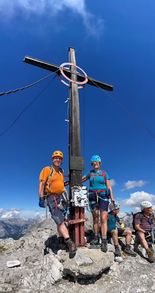
For those new to the concept, a Klettersteig (climbing path) and a Via Ferrata (iron path) are one and the same in German and Italian. Protected climbs using fixed wires as protection with many of the climbs finishing on fine summits. Some routes follow lines created by soldiers during The Great War, others have been created more recently by local guides sponsored by the local authorities to promote tourism. A VF (Via Ferrata) lanyard, a harness, a helmet, tough gloves and a good head for heights is all that is required. The quality of climbing and difficulty can vary greatly. Good route descriptions and gradings can be found in the various available guide books this should mean that climbs can be selected to suit all abilities and fitness levels. The Dolomite VF’s are graded “1” up to “5” subdivided by “a”, “b” and “c”. eg “3c”. It should be noted that like all Alpine venturesobjective dangers can never be totally avoided. More on this later... In particular due to the length of some of the climbs a good eye on the weather is required to avoid being caught on the wires in an afternoon storm, which are common in the Dolomites.
Our first port of call after our journey down was the interesting city of Innsbruck in Austria, staying in the suburb of Rum nearby. Intending to climb the Wankspitz, Keisermax and Innsbruck Klettersteigs we only managed the latter due to wet weather, also both the Wankspitz and Keisermax were temporarily closed. Two days of walking included watching hundreds of competitors in the Red Bull 400 In which competitors of all sexes and ages run up the Innsbruck ski jump against the clock.. This looked short but gruelling. Some of the emergency services teams participating wearing their full equipment including one fire fighting team who wore large heavy leather belts with huge steel carabiners. Huge respect for these guys, many of whom topped out completely spent after only (only!) 400 metres. Not to waste a day we also used the Bergbhan cable car to walk up Rangger Kopfl 1939m in the Alpenrosensteig area. A timely stop at the Rosskogelhutte allowed us to have a beer and watch the rain, a pastime we got well used to over the coming days.
 Summit of the Kemacher
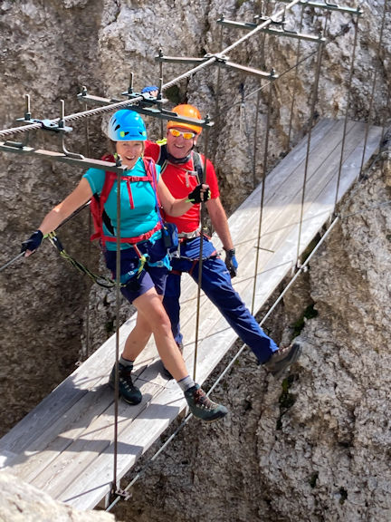
| 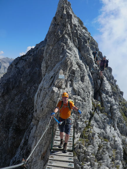 Marcus on the bridge
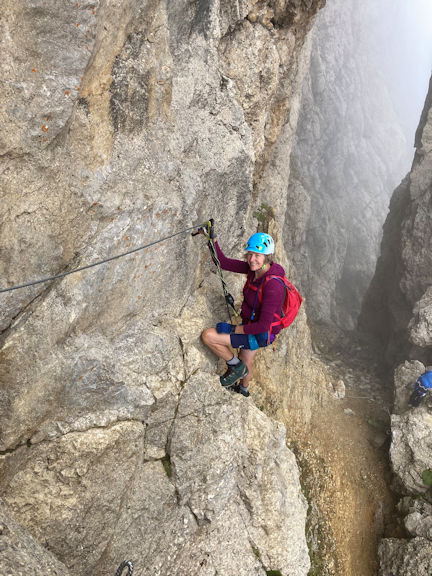
| On our last day in Innsbruck we woke to a very cloudy day. A sneak peek at the local mountain webcams showed an inversion and we soon set off in the hope of enjoying being above the sea of cloud. On one side there was an inversion over the Inn valley, on the other a totally cloudless and sunny view across the Karwendal. A traverse of the Innsbruck Klettersteig was completed in full sun. This route was repeating a route followed by ABMSAC members in Sept 2012. On this occasion I was not violently ill as I was on the previous occasion although I did leave plenty of blood on the route after running my finger into a splintered wire end. This route is an easier graded Klettersteig, albeit quite sustained. We enjoyed superb views over Innsbruck and towards the Karwendal. A good first climb that got us back into using our VF kit. We left Austria and then travelled on to Carezza in the South Tirol. |  Michele moving up
|
Carezza is a small ski resort overlooked by the Latemar on one side and Rosengarten on the other. One of the advantages of staying in Carezza is that when staying in the local hotels they will provide a free lift and bus pass which we intended to utilise to the full. Local guides will tell you that a visit to the Lago di Carezza is a must so we did. Unfortunately as it was late in the season it’s mostly dried up and sorry looking. This does not stop hundreds of tour busses stopping here and the area resembled Skegness on an August Bank Holiday. Better to visit this beauty spot earlier in the year when the lake is full, but it will still be busy.
The first days in Carezza saw low cloud and some rain. Two days of walking were enjoyed using the Paolina chair lift to the Paolina Hutte. Onward routes included visiting Refugio Roda Di Vael and Kolner Hutte for refreshments. The advantage of the bad weather is that we were able to familiarise ourselves with the area. Both the Rosengarten and Latemar mountain areas look worthy of a revisit in the future.
 Between the VF Masre and VF Roda di Vael
| On the next day we intended to climb the VF’s Masare and VF Roda di Vael graded 2B. The two routes traverse the two mountains via ridges. The very good Rockfax Dolomite guide compiled by James Rushforth recommends a traverse from South to North. Ascending from the south we soon found that virtually everyone else’s guide book recommended the opposite. This meant we were heading against the flow but it caused little problem as there were opportunities to pass. Upon reaching the Forcella del Diavolo there is an escape route down a chimney with a ladder. After considering continuing, the rain began to fall and made our decision for us. We descended at this point to the Refugio Roda Di Vael. A typical busy mountain Hut. Neat tip here, just lower down is the quieter Pederiva Hut this is the one the locals use. The elderly proprietor is proud of his home made grappa. If he likes you he will share with you his various grappa…. he did like us! | 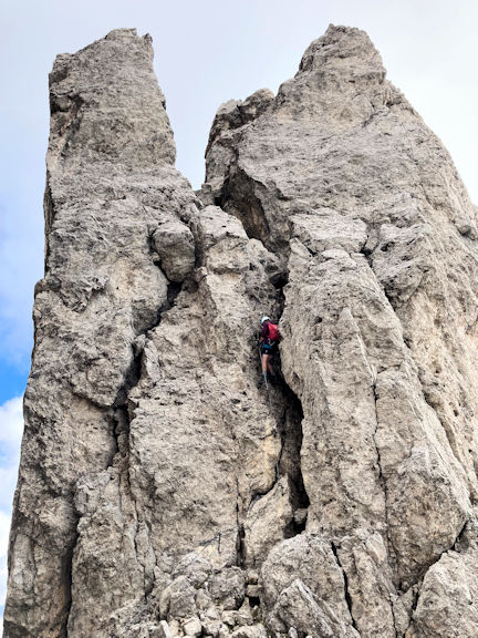 VF Mascare
|
 View from the Roda di Vael
| The following day with better weather forecast we were able to traverse in full the VF’s Roda di Vael at 2806m and the Masare. This time starting at the Vaiolin Pass we traversed North to South across the two Via Ferratas including repeating the VF Masare in the opposite direction. Of course this time we met many parties travelling in the opposite direction! If you do this VF, do it any way you want as there seems to be no right or wrong direction. Apart from being popular the combination of the two routes do offer a really good full day, traversing two fine peaks with superb views in all directions including the nearby Vajolet Towers. The descent route at the southern end of the VF Masare again passes the Refugio Roda Di Vael. | 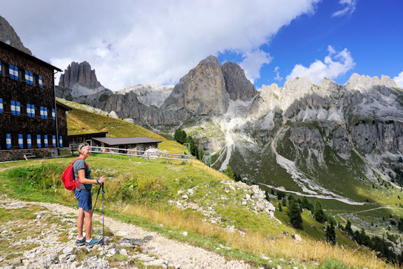 Refugio Roda de Vael
|
After descending via the Paolina lift we again got back in the car. That afternoon we travelled onwards to Corvara in Badia, a lovely evening drive with great views as we crossed the Paso Pardoi.
Corvara in Badia is a favourite of ours, situated in a beautiful valley overlooked by the Sassongher mountain. There are numerous VF’s of all grades. The downside of the easy access to the routes is their inevitable popularity. A photo taken by me on the Piscadou Klettersteig resembles the famous picture by Nirmal Purja of queues on Everest. On our arrival we bought a lift pass for three out of any four days which allows access to all sides of this beautiful valley.
 VF Piz da Lech
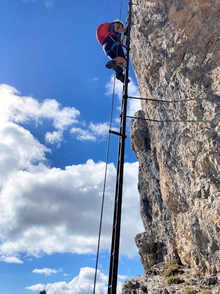
| Our first route in this area was the brilliant VF Piz da Lech graded 3B. Using the Boe Gondola and the Vallon chairlift we rose high above the sea of clouds in the valley. A short walk leads to the VF. Fortunately on this day the climb was very quiet. The highlight of the route are two very exposed ladders, the second of which has an awkward out of balance exit. The exposure at this point is superb, as is the view from the summit at 2911m. From the summit the views below across to the Sassongher, Colfusco, Corvara and towards the Boe are more than worth the effort. The descent allows a good view across to climbers on the ladder sections of the route. After descending to the valley by the same route we dumped our gear at the hotel before heading up the opposite side of the valley by cable car to enjoy a coffee as the afternoon wet weather arrived. | 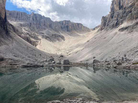 Lake Piscaidu
|
The VF Brigata Tridentina (named after an Italian army division specialising in mountain warfare) otherwise known as the Piscadou Steig is probably the best and most certainly the most popular VF in the area. A 15 minute walk leads from the Tridentina car park to the start. The climb this day was a mixed affair due to the aforementioned crowds on the route. One roped party of five ahead was enough to slow progress to a crawl. The quality of the route is however very good, If you want to do this route go very early morning or late afternoon weather permitting. The route tops out at the Refugio Cavazza al Piscadou. Beer and Bratkartoffeln were then order of the day. We chose the alternative descent route via the Val Mesdi which descended this impressive valley.
|  Bridge on the VF Briggatta Tridentina
| The following day was a transit day heading for a stay at the Refugio Pomedes near Cortina. With good weather forecast we were keen to use the day. Just down the valley from Corvara is the small village of La Villa. Taking the Gardenaccia chairlift and a further ten minute walk found us at the start of the short and relatively new VF Les Cordes .The route name translates in Ladin to “The Ropes”. This VF was created by local man Matthias Peccei in 2019. An easier VF suited to beginners which had enough steep sections to slow down the several families already on the route meaning delays for those behind. However this was a fun route ending at the Gardenaccia hut. A short descent to the chairlift followed and we were soon back to the car. |
A short drive via the Falzerago pass found us parking at the Refugio Dibona. From here a thirty minute walk meant that we could traverse to the Refugio Pomedes via the VF Sentiero Astaldi a longer but more interesting route to our lodgings for the next few days. The evening sun lit up the amazing rock strata on this route. We also saw several chamois grazing on the steep slopes and a lone marmot standing proudly on guard on the slopes below. The Refugio Pomedes stands above Cortina and was built in 1954 in anticipation of the 1956 Winter Olympics. The mens downhill that year started just above the Refugio. Later one of the first Via Ferrattas in the Cortina area was built with the start again being just above the hut. This VF has several sections but subsequently has become known as the VF Punta Anna, a superb VF with longer and shorter alternatives. | 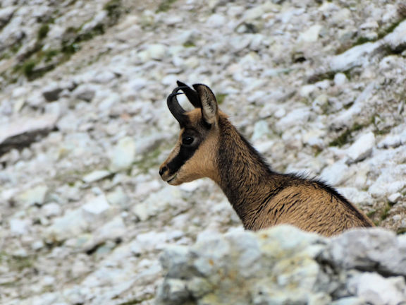 Chamois ( or Comoscio in Italian)
| With a good forecast we were keen to climb the VF Giovanna Lipella which is given a 4C grading. The route is named after an Italian soldier who was posthumously awarded the Gold Medal for valour in the First World War. This was unfinished business for me having climbed the first half with Ian Mateer in 2010. Ian and I were unable to complete the second half due to ice. I subsequently climbed the second half with our current president Andy Burton during the ABMSAC trip to Cortina in September 2014. |
Leaving the Refugio we again traversed the VF Astaldi and a further hour saw us at the route. The VF starts up ladders and tunnels dug by the Italians during WWI and emerges overlooking the Il Castelletto whose summit was blown off by mines laid at the end of the tunnels in an attempt to displace the Austrians.. The route continues, always interesting, traversing and ascending the west side of the Tofana De Rozes. The route eventually emerges at the Tre Dita, a popular escape point. After a short break and a weather assessment, a further traverse east led to the final part of the route. Steep climbing ascends into a huge amphitheatre, in places the water was running down the face making climbing very difficult on the vertical sections. The descent to the Refugio Gioussani is best forgotten as it was to coin a phrase ‘ a tottering pile of choss’. A brief beer and rest at the Refugio was followed by a further traverse back along the VF Astaldi to the Pomedes, our longest day of the trip by far.
The following day it rained, then it rained a bit more and then it continued. We were actually glad of the rest as we had had several days without one. Sitting in the Refugio playing cards having coffee and later a beer, we heard of the passing of the Queen. Both we and the Refugio staff were saddened by the news. We stood and raised a glass of something very small and strong to acknowledge the service she gave to our country.
The next day we dodged more rain and descended to Cortina for a very expensive wet day in the town. We enjoyed the day off and were treated to a procession of concourse Ford Cortina’s gathered there for a rally. It was only the following day that it dawned on me why they’d chosen Cortina for the rally. Doh In my defence I was tired, I’d had a couple of beers and I was suffering a major hit to my wallet!
 On the VF Formenton
| An improvement of the weather meant we could “tick” some more routes in the Cortina area. A short walk and cable cars saw us rise all the way to the Freccia nel Cielo cable car station just below the summit of the Tofana Di Mezzo at 3244m. From here a short walk leads to the start of the VF Lamon Formenton a relatively easy grade 2B. We were surprised to find that there had been a fresh fall of light snow so the start of the VF a descent from the summit was quite tricky. On our arrival on the peak it was blue sky all around but within minutes the Cortina side of the mountain was covered in cloud but the other side remained bright sunshine, although in the shade it was very cold. We were aware that the footpath was closed at the other end of the route, so a circular route could not be achieved. We arrived at the summit of the Tofana di Dentro in lovely sunshine but were unfortunately continually buzzed by a drone used by the juvenile delinquents on the summit so did not stay long. The weather did look like it was deteriorating anyway so we were glad to get moving. | 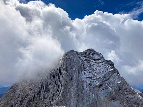 View towards the Tofana di Mezzo
|
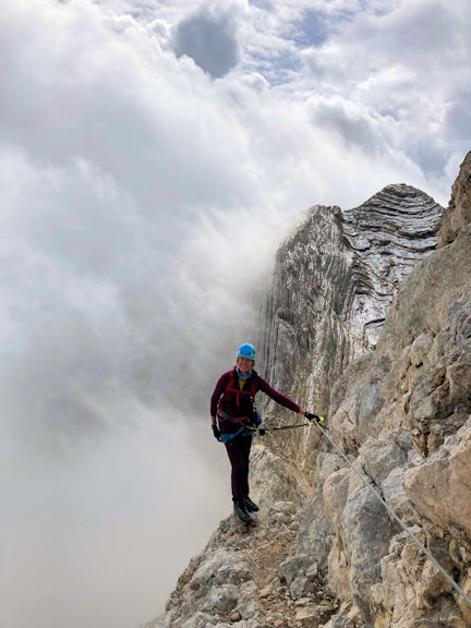
After reversing the route we began the climb back up to the summit of the Tofana di Mezza. By this time the weather was worsening and we had “graupel” (soft hail) bouncing gently off our helmets. Nearing the end of the route Michele suddenly fell back and shouted “Duck!” Actually I believe what she said had an “F” in it too! As Michele fell backwards a large breeze block sized rock missed Michele’s head and struck me a glancing blow on my right shoulder, more rocks followed hitting my leg. The rockfall was over in a moment, bruised and shaken we hastily completed the route. As mentioned earlier the objective dangers are always there in the mountains and have a disregard for guide book grading. We considered ourselves very lucky to walk away from the incident without serious injury. Descent was by the same cable cars and unusually the cable car operator treated us to some music. Fortunately nearly all the occupants were Metallica fans and we all sang along because nothing else mattered.
Another enforced rest day with slightly doubtful weather and nursing some bruising, we travelled up to the Refugio Faloria by cable car. The cable car affords good views of the VF Sci Club 18. From the Refugio a path 222 is marked “Dolomiti panoramic path”. This path descends with great views over Cortina and across to the Monte Cristallo range. In the far distance we could see the back of the famous Tre Cima towers which looked very busy with cars parked all the way down the access roads. This put us off a plan to visit the area to do a VF on the Monte Paterno. After reaching the Tre Croci pass we ascended again by cable car to the Refugio Son Forcia. It was sad to see the unusual Stounies gondola still out of action, closed due to financial and administrative reasons. There are no plans yet to replace the gondola which means that the VF Marino Bianchi and Ivana Dibona are now very difficult to access. After a lunch at the Refugio we descended to Cortina via various paths. A very pleasant rest day.
Our final full day in Cortina found us again at the Faloria cable car. Ascending the first half of the cable car to the Mandres mid station we got off and began our forty minute walk to the base of our route that day. As we walked we noticed that the continuation cable car had stopped above our heads and did not move again for a couple of hours. VF Sci Club 18, graded 5B, was built in 2009 and was at that time the hardest VF in the area. That mantle has been taken by the VF Magnifico Quattro which is graded 6B and is situated in the Val San Nicolo valley. VF Sci Club 18 is a modern “engineered” Via Ferrata. It provides steep sustained climbing on very good rock which is just starting to show some polish. The VF is very well equipped and the stemples have rubber buffers on the steeper sections which decrease the loading on the lanyards in the event of a fall. | 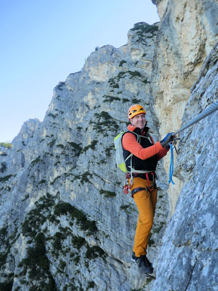 VF Sci Club 18
| We were so fortunate that there was no one else on the first cable car intending to do the same climb as us. Further those unfortunate enough to be on the cable car were stuck in it for two hours after it broke down. This also meant that there were no cable cars for two hours so we had one of the best and most popular climbs in the area completely to ourselves. As we were in the shade and we were on the climb early it was quite cold but we soon warmed up as the climbing is strenuous and steep. As there was no one else pushing us or holding us up we were able to have a leisurely three hours climb to the top. This was followed by lunch at the Rif Faloria enjoying the panoramic views over Cortina and across to the Tofanas. This was the final climb of our trip and a fitting climax to our holiday. |
If you haven’t tried Via Ferratta and perhaps don’t have a lot of climbing experience, this is a great way to introduce yourselves to alpine climbing. The equipment can be bought reasonably cheaply or can be hired from many outdoor shops in the areas mentioned. It is possible to hire a guide to take you on the climbs but this can be expensive, however they have extensive knowledge of all aspects of alpine climbing.
Our return home was via Illertissen and Namur adding to our collection of German and Belgian beers on the way, meaning the car was twice as heavy on the return journey. The Eurotunnel again provided an efficient and quick crossing.
If anyone is interested in experiencing Via Ferrata and would like advice in planning a trip, Michele and I would be happy to help.
The specification of the canal boat was "a 48ft semi traditional stern narrowboat, fitted out to a very high standard and is perfect for a couple's romantic escape". It included a fully equipped galley, saloon with TV and radio, bathroom including a shower, and a sleeping cabin.
We arrived at the boatyard and loaded masses of food onto the boat, intending to eat mostly on board. Since we were first time canal boat users the canal hire company gave us instructions about the boat, including daily greasing of the propeller shaft, frequent filling up of water, mooring the boat and battery charging, then we walked up to the nearby lock and watched others operating it. We had told the hire company that our intended route was south along the Oxford Canal and, after a bit of uncertainty, they confirmed that it was open. At about 3pm, back on the boat after our one hour tuition, our instructor came with us for a couple of hundred yards then I steered to the bank rather badly to drop him off and then we were on our own in a 15 tonne unresponsive expensive floating hotel.
We were using an Oxford canal map produced by Heron Maps, which gives a lot of information about the canal itself and the surrounding area. Soon after leaving Braunston going west, we came to the junction between the north and south branches of the Oxford canal and turned left in the direction of Oxford. This first section of the canal is wide as it is shared with the Grand Union which is a wide canal and has no locks and after 4 hours we moored near to Lower Shuckburgh and cooked our meal on the full sized gas cooker.
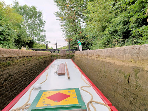
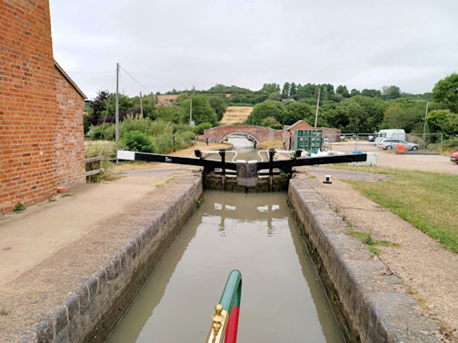 Going through Napton Locks
| Next day, we parted company with the shared canal and headed south on the narrow Oxford canal by Napton on the Hill. From here, you climb through nine locks up to the summit level and, in spite of its being our first attempts at using locks, it went smoothly. We decided that I should drive the boat on this staircase and that Judy would operate the lock paddles and gates as these locks were close together this would also allow her to walk along the towpath to get more exercise. Opening the paddles and gates was hard for Judy as she is no heavyweight, but fortunately other boaters were able to help at times. After Napton Top Lock, the canal goes round a hill then twists and turns in every direction, including back north. We arrived at Fenny Compton and managed to find a space to moor as it is right beside the Wharf Inn and a campsite, so is very popular. Since the pub was so convenient we decided to eat there in the evening but, having been so popular during the day, they had run out of many of the menu items and also draught beer! |
On Monday we continued south and soon entered a section called "Fenny Compton Tunnel" which was originally a tunnel, but was dug out in 1870 leaving a straight but very narrow 1km stretch of the canal with few passing spaces, but fortunately we did not meet any other boats.
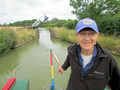 Judy happy to be past the bridge
| Along this section of the summit level, we grounded and in spite of all our efforts to refloat the boat, we had to be dragged off by a boat going in the opposite direction, which then itself grounded! The next stage was the descent from Claydon Top Lock down to Cropredy. Whilst waiting to enter one lock, I tethered the mooring line with a clove hitch onto a bollard and went to help with opening the lock paddles, but when I looked back at our boat, I saw it drifting in the centre of the canal as the knot had undone. Fortunately I could reach the mooring line from the towpath and pull the boat to the bank. | 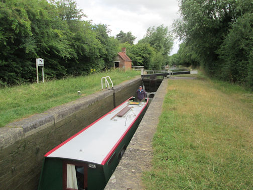 Don controlling the boat in a lock
|
At Cropredy we moored before the lock and walked into the town to investigate and found the the Brasenose Arms, which we booked for dinner. The town is famous for at least two things, firstly the battle of Cropredy in 1644 which was the first English Civil war and secondly the Cropredy music festival, formerly the Fairport Convention music festival.
Next day we filled up the water supply by the turning point in Cropredy then continued south towards Banbury, and soon saw that boats coming up the canal were grounding near to a bridge, but eventually they managed to refloat and continue. Since there was no turning point (winding point) before Banbury we were forced to continue.
 Judy operating the paddles
| On the way we grounded two or three times but with great difficulty managed to get going again, using both the 10 foot long pole and lots of forward and back revving of the propeller. We moored just before the winding point and walked into the Tesco store to buy supplies, before returning to the boat and doing my first three point turn in a 48ft canal boat. Our concern was that we had to retrace our route back to Cropredy and knew that we would ground again as the water levels were so low. At one point we were helped by canoeists who got out of their canoes to help push us, at the same time that other canal boats were pulling and we were using the 10 ft pole. Nearer Cropredy, where we had seen boats getting stuck by a bridge in the morning, we again grounded and it took ages for us to get going again. We moored just opposite the canoe club, exhausted after the days efforts and cooked our food in the galley. | 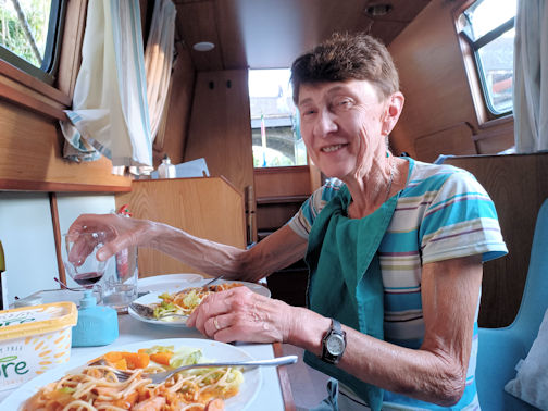 Judy enjoying a meal on the boat
|
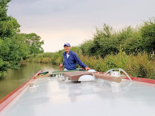 Judy steering in a quiet section
| The next day (Wednesday) we got stuck just as we tried to enter the lock, but fortunately canal trust staff and other boat users were able to pull us into the lock. Apparently the next section (pound) had been completely dry during the night and we had to wait until the canal trust staff allowed water to flow into this section. Water shortage is a problem this year, not only because of low rainfall, but the lock gates leak badly and people have left paddles open. The next 8 locks took us back up to the summit level, and we went through the "Fenny Compton Tunnel" section again without meeting oncoming boats, much to our relief. We passed by Fenny Compton and the Wharf Inn, which was not crowded as it was not a weekend and made another water stop, then followed the very twisting canal around Wormleighton. When we had passed this area on our way south, we had seen vast areas of spoil in the fields to the south east and this day there were many lorries and earth moving machines working here. We then saw notices on either side of the canal referring to HS2 which would be crossing the canal at this point. We continued a bit further on and stopped below Priors Hardwick at a nice quiet mooring, leaving the descent of the nine Napton locks until the next day. |
On the Thursday, we passed through all the locks with other canal users coming in the opposite direction helping us with the paddles and gates. We reached Napton Bottom Lock and the Folly Inn at lunchtime, and since there was a convenient water supply there, we got out the long hose and topped up our water. The map showed that there was a village store close by in Napton on the Hill, so Judy walked there, a bit further than expected to buy some tomatoes and nectarines. There were no more locks on our route and we passed by the junction where the Grand Union Canal goes to Coventry. In the afternoon we passed by a field with a large herd of Buffalo looking impressive with their big horns. We moored below Flecknoe, and booked a table in a pub called Old Olive Bush. That evening we walked along the towpath then up the minor road to this village on the hill. Most of the clientele were from boats moored near us, and the lady running the pub had to do everything on her own, including serving drinks, taking orders and cooking the meals, however everything was first class. | 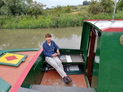 Judy relaxing in the afternoon
|
We had one more day (Friday) before we had to return the boat by 9am on the Saturday, so since we were not far from Braunston our starting point, we decided to do a short section of the north section of the Oxford canal. We had intended to go as far as the Hillmorton Paired Locks, which have three gates for two locks, thus only allowing one-way traffic. At the junction of the canals, we filled up with water and shortly afterwards, we grounded badly and it took over half an hour to refloat the boat. We could see that another boat had also grounded not far ahead and since there was no turning point we had to continue north. Because of this upset we turned round at the first winding point at Dunchurch Pools Marina and retraced our route, stopping at lunchtime by Willoughby Wharf before the point where we had grounded in the morning. During our lunch stop as we were sitting on the towpath, we saw a grass snake swimming in the canal a couple of times. After lunch, we motored as carefully as possible to stay in the deeper water, until we arrived at the junction with the Grand Union canal. Braunston was close and we moored opposite the Boathouse Inn and walked into the village to investigate the three pubs, one of which we booked for dinner. On our return to our boat, we called in at the office of our starting boatyard to tell them that we would be returning the boat next day by 9am.
On the Saturday, we travelled the short stretch back to the boatyard and unloaded our gear, including our left-over food.
The trip was enjoyable, passing through beautiful countryside with stunning views and wildlife including many swallows, moorhens, two mink and the snake. We even had moorhens walking the tightrope along our mooring rope trying to get onto our boat, plus dogs jumping in from the towpath. There was a lot of camaraderie with other friendly boaters helping us at the lock gates and when we grounded. If the water level had been higher we would not have been so stressed about getting stuck, with the possibility of not being able to refloat the boat. We both suffered bruises and strained muscles trying to refloat the boat and I am sure that the propeller suffered a lot as it was hitting stones on the bottom of the shallow canal. The weather was perfect, but with a strong wind at the start and we only had rain once or twice when moored in the evening. We might like to try it again some time, but would want the water level to be higher.
What we needed after this trip was a holiday so we booked an airbnb place in Kent, in a converted stables on a former farm and went to see Judy's relations, visited a national trust property and went swimming many times.
This was a walk that was planned pre Covid and was rescheduled for this year. When we first booked the dates we were not walking over the Easter break, but our dates coincided with Easter this year. We decided to go ahead.
As well as Easter 'moving' other things had changed. The early morning flights to Glasgow had been rescheduled to arrive mid morning, rather than the pre Covid early morning arrival time. Paul and I had to review and change our travel plans.

Ed tucking in
| Good Friday saw Paul and I driving up North to meet up with Ed at the GSH. Surprisingly we met very little traffic and arrived in a little over 4 hours. In time for a pre dinner pint at the White Lion. Ed arrived shortly after and refreshed at the pub he set about preparing our evening meal - homemade pasta and mushroom sauce - delicious Ed. After dinner we were joined by our neighbours and caught up on each others news.
| 
homemade pasta
| |
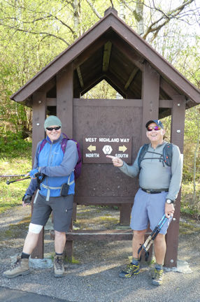
Day 1 Milngavie to Drymen – 12.5 miles, 780’ ascent
We left the GSH at 6am and after another clear run dropped our bags off at the luggage van. After a second breakfast we were ready for the off at 10am.
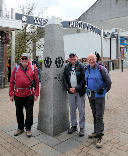
The Gang of 3
| 
the route to come
| |

Distillery
| We set out towards Drymen through Mugdock Country Park and along an old railway line, passing the Glengoyne Distillery along the way. We stopped at the little café at Dumgoyne and sampled the Haggis bon bons. Crossing over Endrick Water at Gartness we arrived at the Drymen Inn in the late afternoon.
| |
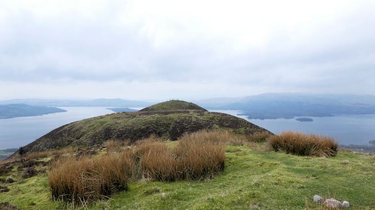
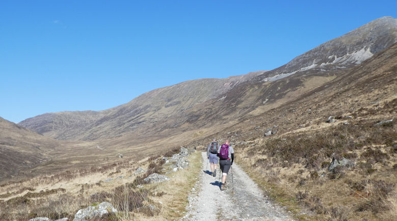
Day 2 Drymen to Rowardennan – 15.8 miles, 2450’ ascent

Loch Lomond and Conic Hills
| 
Loch Lomond from the top
| |

descending the eroded path to Balmaha
| We left Drymen at 9am and headed towards the Conic Hills. We enjoyed a detour along the whole ridge, taking in all the summits. We then descended to Loch Lomond to Balmaha. Time for coffee and cake.
| |

Tom Weir
| 
After paying our respects to Tom Weir (creator of the walk) we continued along the banks of Loch Lomond, walking along beaches and up and over wooded glades in the afternoon sunshine. A lovely walk.
| |
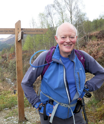
Active Recovery Day, no 1 – 8.5 miles, 3100’ ascent
Another early start saw us ascending the good path up to the top of Ben Lomond and over the tops and down via the Ptarmigan Ridge back to the loch side.

Paul raring to go
| 
Ed raring to go

view on the way up
| |

team on the summit
| 
Paul pointing out the hills
| |
The day improved as we went along, finishing in sunshine at the Hotel for refreshment.
Day 3 Rowardennan to Inverarnan – 14.6 miles, 2200’ ascent

lochside walk
| 
last look at Loch Lomond
| |
This was a lovely walk along the Loch side in spring sunshine, the path was tricky in places. We stopped for coffee and cake at Inversnaid before continuing along the wooded path.
Through the trees we got glimpses of Tarbet and Inveruglas on the opposite bank and the small ferries. Eventually we reached the end of the loch.

Paul at the bothy
| 
Nearing the end

the chalets
| |
We passed the Doune Byre Bothy on our way to our chalet at Beinglas Farm at Inverarnen.
Day 4 Inverarnan to Tyndrum – 12.3 miles, 1630’ ascent
A great hike through some lovely forest paths and spectacular scenery. We stopped above Crainlarich for lunch with the Crainlarich Hills as a backdrop.
After lunch we walked through areas of cleared forest, the lumberjacks have been very busy. The maps now need updating!

Paul and Ed
| 
Crainlarich Hills coming into view
| |

Crainlarich Hills
| 
tree cutting complete
| |
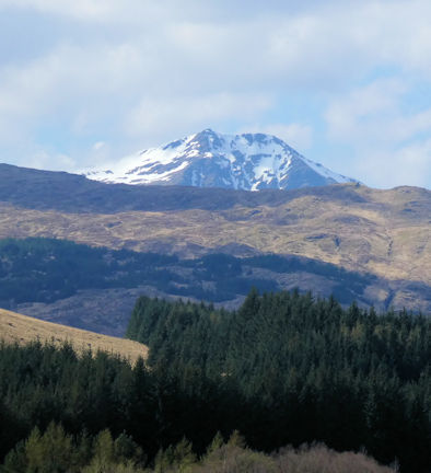
In the distance we caught a glimpse of a snow topped Ben Lui.
On the way to Tyndrum we passed the ruins of Fillans Priory, along with its ancient graveyard.
We continued along the river to Tyndrum. We visited the ‘Green Welly Stop’ to stock up on lunch for tomorrows big walk across Rannoch Moor.
Ben Lui
| 
Fillans Priory graveyard
| 
'Green Welly Stop'
| |
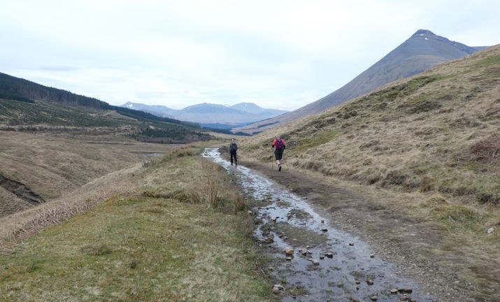
Day 5 Tyndrum to Kingshouse – 20 miles, 2090’ ascent
A brilliant walk passing through the Bridge of Orchy, morning coffee and scone stop.
Walking along the valley, having just left Tyndrum
| 
2nd breakfast!
| 
The Bridge of Orchy
| |

Suitably fortified we were ready for the walk over Rannoch Moor via the old drovers road to Glencoe. A late lunch on the edge of the moor was most welcome.

The start of the Drovers Road
| 
Crossing the moor
| |

Walking across the moor was fascinating. We detoured up to Rannoch Point for great views across the moor. We were soon crossing the Glencoe ski area and dropping down to the road and then to the new Hotel at Kingshouse.

Rannoch Point
| 
view from the Hotel
| |
Day 6 Kingshouse to Kinlochleven – 9.2 miles, 1320’ ascent
After a restful night and excellent venison burgers at the Kingshouse we set off for a shorter day over the Devils Kitchen and back down to sea level.

Ed and Paul ready for the off
| 
Ed and Mike setting out down Glencoe
| 
Off down Glencoe to the Devil's Kitchen
| |
Another day of stunning views and weather. The scenery brought back memories of many days spent winter climbing in Glencoe.

At the Devils Kitchen with Ben Nevis in the backgroud
| 
The track down to Kinlochleven
| |
We arrived in Kinlochleven in the mid afternoon and enjoyed a couple of well earned pints.
Day 7 Kinlochleven to Fort William – 15.8 miles, 2080’ ascent
The last day of the WHW. Another day of lovely views in perfect walking weather.
As we climbed up to the Larigmor we paused to look at the Pap of Glencoe and then higher up the Mamores came into view.
Ed and Paul show the way
| 
Looking down the Loch
| 
Walking in the Larigmor
| |
Our route skirted the big peaks and then Ben Nevis came into view. We walked through the much depleted forest high up in Glen Nevis and then took the forest track down into Fort William.

Ben Nevis comes into view
| 
On the way down to Fort William
| 
'Original' finish
| |

Bonus Day, Ben Nevis – 10 miles. 4260’ ascent
Refreshed from our exertions of the WHW we had an ‘active recovery day, no 2’ with an ascent of the Ben, via the Tourist Route.
We were all tired but happy on completing the way. The Ben was to be the cheery on the icing of the cake.
We took a taxi ride up to Achintee and set off up the path. We had extensive views across Glen Nevis, seeing yesterday’s descent route and the Mamores.

Happy crew at Achintee
| 
Looking across to Glen Nevis
| |

On the zigzags
| 
Happy crew #2
| |
The last 100m was a snow field, where our crampons made the going easy. From the summit we could see forever.

Summit plateau
| 
Happy crew #3
| |
On our return we rehydrated at the Ben Nevis Inn at Achintee.
Many thanks to Paul and Ed for their company over the nine day trek.
Overview
We completed the 96 miles in great weather, having some magnificent views, great overnight stops, good food and by no means last good company for the week.
We were surprised by the number of walkers, the different nationalities and the range of ages doing the walk. We were the oldest group on the walk that week.
We used Gemini Walks to book our overnight stops and move our luggage each day.
Thanks to Paul and Ed for the use of a few of their photos for this article
